The Town of Oakville is located on the Treaty lands and Territory of the Mississaugas of the Credit. We acknowledge and thank the Mississaugas of the Credit First Nation, the Treaty holders, for being stewards of this traditional territory.
From the original settlement by the Wendat Nation, to today's bustling town, Oakville has a rich and fascinating history

The area that is now Oakville was once made up of various villages and hamlets. These included Palermo, Omagh, Drumquin, Postville, Boyne, Ash, Bronte, Glenorchy, Hornby, Merton, Munn's Corner, Proudfoot Hollow, and Sheridan, all of which had shared resources and traded with each other over the years, making their histories intertwined and linked. Although Oakville officially amalgamated with Trafalgar Township in 1962, the area has a fascinating history that dates back much further. European and American settlers began arriving in the early 1800s. Still, before that, the area was originally home to Indigenous Peoples who practiced agriculture, hunted, fished, and traded in the region until 1847.
A Brief History of Oakville from the 1400s to the present
Indigenous History (Rooted in the Land)
Huron-Wendat Period c. 1400 - c. 1650: The Wendat Confederacy was formed among the “Cord”, “Bear”, “Rock” and “Deer” as a defensive response to the Haudenosaunee Confederacy to the south of Lake Ontario. The Wendat Nation belongs to the Iroquoian linguistic group. The people of the Confederacy were scattered in villages in present day Simcoe County, the Trent Valley and the north shore of Lake Ontario. Wendat villages stayed in one location from anywhere between 15-20 years. Once soil fertility and the supply of firewood within carrying distance became exhausted, the village would relocate a short distance away. The French named the Wendat people "Huron" as their hair supposedly resembled that of a boar's head. The Huron-Wendat diet consisted of fish and the three sisters - corn, beans, and squash. Agricultural products were traded with other First Nations in exchange for tobacco, wampum and copper, amongst other goods. Upon the arrival of the Europeans, the Wendat became the middleman in the fur trade carried on by the French. The Wendat were likely the most important suppliers of beaver pelts to New France.
Haudenosaunee Period c. 1650 - c. 1695: The Haudenosaunee have also been historically known as the Iroquois, the Five Nations Confederacy and the Six Nations Confederacy. The original Confederacy was located south of Lake Ontario and consisted of the Mohawk, Oneida, Onondaga, Cayuga and the Seneca Nations with the addition of the Tuscarora in 1722. Recognizing that prime beaver pelts could be obtained in the lands north of Lakes Ontario and Erie, the Iroquois moved into the region dispersing the Huron-Wendat, Petun and Neutral Nations. The term Haudenosaunee means “people of the longhouse”. While the Huron-Wendat, traded with the French, the Haudenosaunee traded with the Dutch and later, the British. From about 1652 until the end of the 17th/ century, Southern Ontario was Haudenosaunee hunting ground. The Cayuga, Seneca, and Oneida established several villages along the north shore of Lake Ontario. To establish greater control of the fur trade, the Haudenosaunee moved north into the lands of the Anishinaabe people.
Mississauga Period c. 1695 – Present: In response to Haudenosaunee incursions into their lands in Northern Ontario, the Anishinaabe successfully pushed the Iroquois out of Southern Ontario by the end of the 17th century. Mississaugas of the Credit ancestors, a sub-group of the Anishinaabe, had driven out the Iroquois at the western end of Lake Ontario and took up approximately 4 million acres of land as their territory. A series of treaties made with the British Crown between 1781 and 1820 saw the land base of the Mississaugas of the Credit reduced to 200 acres located at the Credit River.
European Settlement
While the land was still owned by the Mississaugas, in 1793 a military road from York (now Toronto) to Dundas, at the head of the Lake, was surveyed, but could not be built through Indian land. In 1806 the “New Territory” was surveyed into lots by Provincial surveyor Samuel Wilmot. He used the 1793 Dundas Street Survey as his reference line, dividing the land by Concessions running about east-west, two concessions north of Dundas Street, and four between Dundas Street and the lake. Lines and Concessions created blocks of 1000 acres each, which divided into five settler lots each of 200 acres, though at the fourth concession, the irregular lakefront created lots of various sizes.

From east to west, Wilmot created three Townships, which he initially named Toronto, Alexander, and Grant. But the news of Nelson’s victory at the Battle of Trafalgar soon reached the colony. Patriotically the two western Townships were renamed Trafalgar and Nelson.
These concessions are still referred to as 3rd Concession SDS (South of Dundas Street). 1st Concession SDS ran from Dundas down to the Upper Middle Road. 2nd Concession ran down to what was the Lower Middle Road and is now the QEW/Royal Windsor Drive. 3rd Concession ran to Lakeshore Road/Rebecca Street and the 4th Concession is a Broken Front Concession bounded by Lake Ontario. 1st Concession runs to Burnhamthorpe Road. 2nd Concession is bounded by Lower Base Line. The lots in the original survey were referred to as the Long 200s.
A number of lots were reserved for the Crown and the (Anglican) Church. The rest were quickly taken up by settlers. To acquire full title to a piece of land the settler was required to clear and fence at least five acres, to build a house about 16 by 20 feet, and to clear the road adjacent to his land; together a substantial task in the densely wooded Townships. Land through which streams flowed was eagerly sought, both for access to drinking water and fish, and for water power to drive grist mills (grinding grain) and sawmills for creating building beams from logs. It was a lonely, hard working life.
19th Century
By 1820, the Mississaugas had decided to sell their reserved land at the mouth of the Twelve (now Bronte) and Sixteen Mile Creeks. The land was sold to the Crown and the money was used to build a village for the Mississaugas on the Credit River at what is now the Mississauga Golf Club.
Put up for auction by the Crown in 1827, the 960 acres at the mouth of the Sixteen were bought by William Chisholm, a successful businessman and politician living by Burlington Bay. It was Chisholm’s vision that a town and harbour at the Sixteen would be a centre through which goods could flow and grain be exported from farm lands to the north.
Though Chisholm himself did not move to the new village named Oakville until 1838, he appointed agents to handle development. Immediately, the mouth of the Sixteen was protected by piers and the harbour dredged, a shipbuilding yard was set up (at the north end of Navy Street) and the village was surveyed into streets and building lots for tradesmen, mariners and workmen. Further upstream, the Sixteen was dammed for water power and a grist mill/sawmill was built. The harbour was built with private funds and for this William Chisholm was authorized to levy duties and tolls on goods arriving and leaving.
The first “crop” produced from the forests was timber and, particularly for making barrels, staves were produced from the White Oaks of the forest. Heavier timbers were used for home building and ship building and more was exported by schooner to larger communities on the Lake or the St. Lawrence River. Pine from the area was used for building and masts for ships of the Royal Navy.
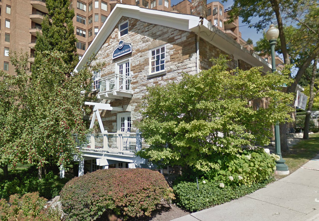
As settlement developed, wheat became the important export and wheat rolled down the new plank road (it was a toll road), the Seventh Line, now Trafalgar Road, for shipping from the harbour. Taking advantage of this, a number of businessmen bought from the farmers, erected warehouses for storage and arranged shipment to market. Most of the warehouses were built of wood. Only their foundations may now survive, but a stone warehouse build circa 1855 by Romain and MacDougald still stands by the Sixteen at the foot of Robinson Street and Water Street. The warehouse is known as The Granary. The building has been renovated since. A large condominium next door has taken on The Granary name.

The village prospered, so that in 1857 it was incorporated a Town (municipality). Its first Mayor was George King Chisholm, eldest son of Oakville’s founder William Chisholm, who had died in 1842.
But in the 1870’s two things happened to depress the community. First, at the conclusion of the Crimean War in 1856, there developed a surplus of world wheat; second, the Grand Trunk Railway was built bypassing Oakville to the North. Together these seriously curtailed shipments through the harbour and revenue from movement of goods was not adequate to keep the harbour dredged and in repair. The Chisholms put it up for sale; one purchaser tried to work it, but failed. In 1874 it was purchased by the Town of Oakville who have owned it ever since.
The loss of a prosperous harbour also caused failure in 1871 of an important business, the Doty foundry on the west bank of the Sixteen.

Struggling to survive, farmers and smallholders in the Town turned to fruit production, with strawberries a principal crop. Introduced by John Cross at his farm remembered by Cross Avenue, his farm location, many growers followed suit. By the mid-1870s Oakville had become the greatest strawberry growing district in the Dominion and became known as the strawberry capital of the Canadas. To support the shipment and sale of the delicate fruit, Cross designed and began manufacturing wooden veneer "strawberry" baskets in the 1860s. Initial production was in sheds on the Cross and John Alexander Chisholm farms. Later production moved to a basket factory built in a converted brewery on Dundas Street (Trafalgar Road). John A. Chisholm also set up basket production in a shed at Division Street (Macdonald Road) that used a wood paring device developed by his son Charles. Vulnerable to fire, three times the factories were lost and rebuilt on the Trafalgar Road sites.
Whisky and beer are by-products of the grain business. The Oakville Brewing and Distilling Company began operating in 1836 on Walker Street, overlooking the harbour. One of Oakville's leading industries during its short existence, it distilled sixty gallons of whisky a day. Another brewery soon started up close to the river bank on Dundas Street (Trafalgar Road) at Division (Macdonald) Street - the steam brewery - of which James Brown was proprietor in 1858. About 1863 Henry Hogben took over this business, which later became "Mr. Townsend's Brewery". When Francis J. Brown became proprietor, about 1870, he called it the Victoria Brewery. It ceased operation in 1870, and four years later became the new Chisholm basket factory. Hence that stretch of Trafalgar from south of Macdonald to 6th Line was often referred to as Basket Factory Hill.
After the Victoria Brewery ceased operation the Chisholms' expanded basket operation moved into that building (by the Creek at Trafalgar and Macdonald) in 1874. In 1889, Pharis Doty & Son took over the Chisholm factory and three years later founded the Oakville Basket Company. Fire destroyed it in 1893, but it was rebuilt, to be burned down again in 1920. It was again rebuilt, further to the north, south of the railway, and remained in operation until 1984. That site until recently (2001) was marked by the flywheel which powered its operations. That artifact is now part of the Oakville Heritage Trails "Pioneer Industry" pavilion which overlooks The Sixteen from its banks on the south side of Speers by the former Old Mill Road.
Another victim of fire in 1866 was an oil lamp refinery producing coal oil or kerosene for use in lamps. Located on the east bank of the Sixteen it was approximately opposite the junction with Lawson Street. Owner Richard Shaw Wood had built a home nearby, appropriately nicknamed by Town inhabitants “Kerosene Castle.”
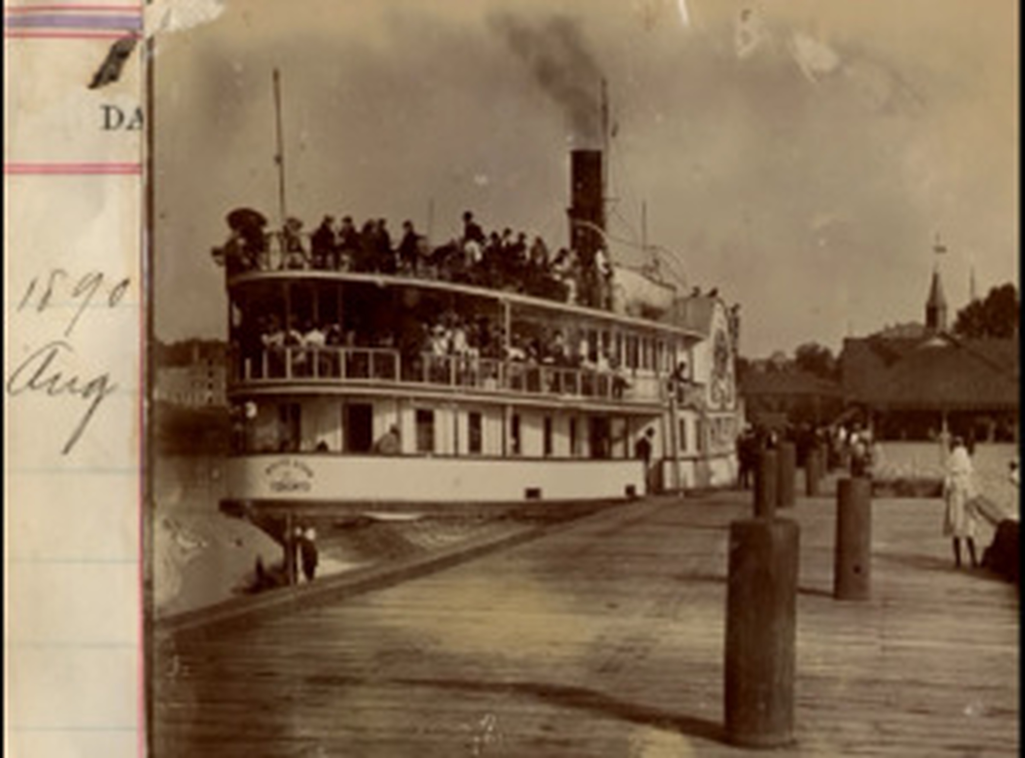
Because of its attractive location and style and pleasant summer weather, Oakville also became the destination of summer visitors, for the most part from Toronto, many arriving by steamship. One of these, the “White Star,” also was given a local name, the "Sunday School Boat,” because of the frequency with which it catered to Sunday School outings. The great number of visitors, up to 3000, which could arrive on a single day, gave the Townsfolk opportunities to sell teas and to provide overnight accommodation. Besides strawberries, other fruit orchards produced apples, pears, and plums, with the Basket Company offering appropriate containers.
Several small industries opened for business in the Town, notable among them the Glassco Jam factory, a factory producing aluminum kitchenwares, and the building of yachts.
20th Century
Early in the 20th century, wealthy city gentlemen, who could commute to their city employment by train, developed the Lakeshore through the construction of large summer homes. Gradually these homes became permanent, often with large grounds or estates.
The automobile reached Oakville for the first time in 1909/10 but could not be used for commuting until in 1915/16 when Lakeshore Road between Toronto and Hamilton was paved – with concrete – for the first time. It was the first paved highway in Ontario. But it was not until the Queen Elizabeth Way was opened in 1939 that “easy” commuting became possible; both ways; into Oakville from the cities of Hamilton and Toronto, and to the cities from Oakville.
In 1962 Oakville amalgamated with the Township of Trafalgar to become the largest Town in Canada, running from the Lake to Steeles (Milton was surrounded on three sides) and from Burloak to Winston Churchill. Many streets were renamed at that time. In 1974 Halton County became the Regional Municipality of Halton and the municipal boundaries were redrawn. Much of the north part of Oakville became part of Milton and the land east of Ninth Line, north of Dundas, became part of Mississauga. Oakville has, however, remained a Town in fact and in spirit.
An early consequence of this was the settling in Oakville of the car manufacturer, Ford. From that time on, Oakville grew from a small sleepy Town to the large municipality it now encompasses, having taken within its boundaries early neighbouring villages, Bronte, Postville, Palermo, Proudfoot’s Hollow, Merton and Sheridan.
Credit: Written by Harry Buxton (Oakville Historical Society) - 2002 Edited and updated in 2020
Oakville Timeline
To help you understand Oakville's rich and diverse history, we have created a timeline of important events and interesting facts: this timeline is a "living document" that will continue evolving and growing.
We are immensely grateful to all the individuals and organizations who have contributed to the creation of this timeline. We would especially like to thank Michelle Knoll of the Trafalgar Township Historical Society for her invaluable contributions, feedback, and time in support of this project.
Oakville Timeline (opens the pdf)