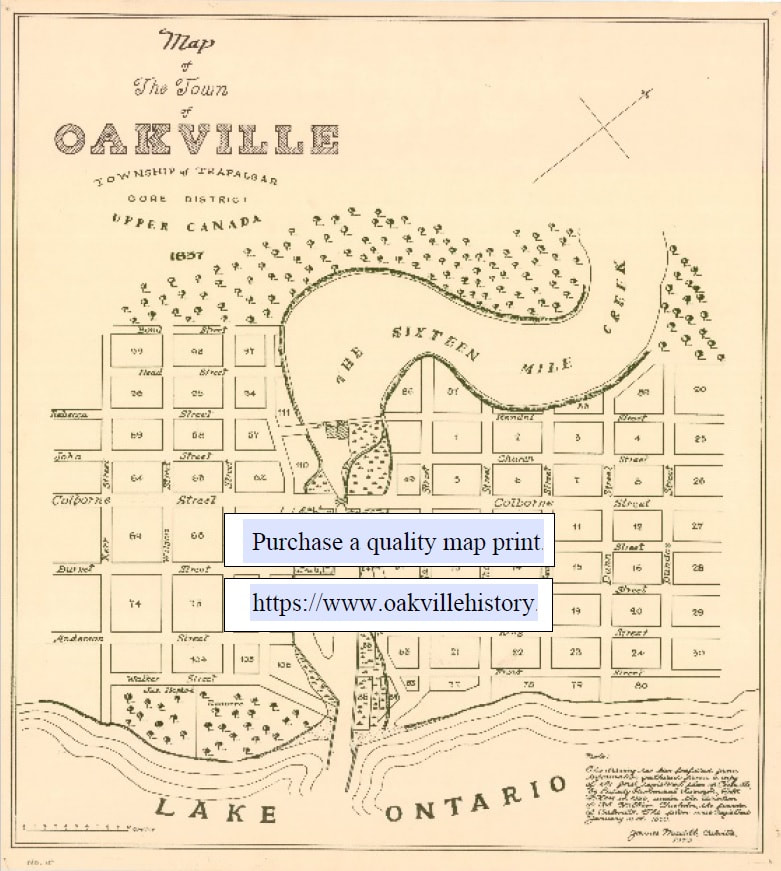
Map Oakville 1837
James Madill
This drawing has been prepared from information gathered from a copy of the first registered plan of Oakville, by Deputy Provincial Surveyor, Robert H. Kerr in 1836, under the direction of Col William Chisholm, the founder of Oakville. The plan was registered January 12, 1850.
This map is about 10" x 10". It is printed on high quality matte paper, suitable for framing.
Plaqued copies are available for an additional cost of $25.
